Wednesday, September 4, 2019

Ascot in the Outback / Ascot en el Outback


Normanton House
Aug 29 - Sep 3

We started the day heading to Cobbold Gorge on the dirt road; soon a new noise appeared. We stopped to check and found a support bolt broken in the roof rack. We checked the others to be sure the rack was safe and continued on our way, but the sound continued so we stopped again and finally we found the source - one of the anchor points on the roof rack was broken, and we had four more cracks at other points; finally the corrugations had sent us the bill. After first aid we continued on our way very slowly to avoid additional damage, so the one and a half hours to Gregory Downs became four.
First aid
Comenzamos el día rumbo a Cobbold Gorge por el camino de tierra; pronto apareció un nuevo ruido. Nos detuvimos para verificar y encontramos un perno de soporte de la parrilla roto. Verificamos los demás para asegurarnos de que la parrilla estuviera segura y continuamos nuestro camino, pero el sonido continuó, así que nos detuvimos nuevamente y finalmente encontramos la fuente: uno de los puntos de anclaje de la parrilla estaba roto y teníamos cinco grietas más en otros puntos; finalmente las corrugaciones nos habían enviado la factura. Después de los primeros auxilios, continuamos nuestro camino muy lentamente para evitar daños adicionales, por lo que la hora y media hasta Gregory Downs se convirtió en cuatro.

In this small remote place the capability to solve the problem was nil, so we had to continue other 400 Km to arrive at a place with more infrastructure; this was Normanton, a town with 1250 inhabitants close to the Gulf of Carpenteria. The highway was not at all exciting, however spotting several dozen Brolga was really stimulating.

Brolgas flying
En este pequeño lugar remoto, la capacidad de resolver el problema era nula, por lo que tuvimos que continuar otros 400 km para llegar a un lugar con más infraestructura; Este fue Normanton, un poblado con 1250 habitantes cerca del Golfo de Carpenteria. La carretera no fue para nada emocionante, sin embargo, ver varias docenas de Brolga fue realmente estimulante.

As we now know, each problem with the car is a great opportunity to enter more deeply in the real life of the people. The first place we tried was closed with a number to call; we are still waiting for them to call back. At the second place a big tall guy attended us, looking in silent mode at the car, checking again what we showed him, and then leaving to do other things. Then another round of observation, finally he communicated to us his intention to call a welder, followed by silence again. After a while, the third round of inspection; after which he took the car into the workshop and started to dismantle the roof rack. Another man arrived, the welder. He made his own inspection, and then took the roof rack in his car and disappeared with Alan. Then the silent guy said to Marce,  “you can follow them”, giving her some instructions about where they were going.

Como ahora sabemos, cada problema con el automóvil es una gran oportunidad para entrar más profundamente en la vida real de las personas. El primer lugar que visitamos estaba cerrado con un número para llamar; todavía estamos esperando que devuelvan la llamada. En el segundo lugar, un hombre alto nos atendió, mirando en silencio el auto, revisando nuevamente lo que le mostramos y luego saliendo para hacer otras cosas. Luego, otra ronda de observación, finalmente nos comunicó su intención de llamar a un soldador, seguido de nuevo por el silencio. Después de un tiempo, la tercera ronda de inspección; después de lo cual llevó el automóvil al taller y comenzó a desmantelar la parrilla. Llegó otro hombre, el soldador. Hizo su propia inspección, y luego puso la parrilla en su auto y desapareció con Alan. Entonces el tipo silencioso le dijo a Marce, "puedes seguirlos", dándole algunas instrucciones sobre a dónde iban.

Rodeo
Finally, in the welding workshop, we were able to say “hello” and ask for the welder’s name, and then a warm interaction started. Ron is a strong local man in his 70s, who guided us to his son’s restaurant for breakfast and gave us an orientation to the tourist attractions in the town before starting work. Both were very kind, and both have that outback style: serious, distant, however once finally the ice is broken they are the most warm, helpful, and kind people.

Rodeo
Finalmente, en el taller de soldadura, pudimos decir "hola" y preguntar el nombre del soldador, y luego comenzó una cálida interacción. Ron es un hombre local fuerte en sus 70’s, que nos guió al restaurante de su hijo para el desayuno y nos dio una orientación sobre las atracciones turísticas de la ciudad antes de comenzar a trabajar. Ambos fueron muy amables, y ambos tienen ese estilo del Outback: serios, distante, sin embargo, una vez se rompe el hielo, son las personas más cálidas, serviciales y amables.

Visitor centre at Normanton
Normanton was surprising, the town has several beautiful old buildings, there are people fishing in the Norman River, and it’s full of activity; the community arrived at the pubs at the end of the day to get together, everyone was at the school fête, and enjoyed the races and rodeo on Saturday.

Normanton fue sorprendente, la ciudad tiene varios edificios antiguos hermosos, hay gente pescando en el río Norman y está llena de actividad; La comunidad llegó a los bares al final del día para reunirse, todos estaban en la fiesta de la escuela y disfrutaron las carreras y el rodeo el sábado.

Karumba Point
When we learned of these events we decided to stay one more night. We spent the morning of our additional day exploring Karumba, a town on the Gulf of Carpenteria. On the way a huge flock of Brolga took up part of our time; seeing them in this huge group, watching their delicate movements, coming and going, and recognising their sounds and calls was delightful. In Karumba Point the view of the mangrove, the people fishing, and the birds all around made a very refreshing experience.


Cuando nos enteramos de estos eventos, decidimos quedarnos una noche más. Pasamos la mañana de nuestro día adicional explorando Karumba, una ciudad en el Golfo de Carpenteria. En el camino, una gran bandada de Brolga ocupó parte de nuestro tiempo; Verlos en este enorme grupo, observar sus delicados movimientos, ir y venir, y reconocer sus sonidos y llamadas fue una delicia. En Karumba Point, la vista del manglar, la gente que pescaba y las aves a su alrededor hicieron una experiencia muy refrescante.

Some of the participants

In the afternoon we explored the races; imagine our surprise with the elegance of all the attenders, women in pink dresses, hats, gloves, high heels, and very sophisticated accessories, men with pink touches, elegant jackets, and their best hats, children with their best pink flowered dresses. In the programme was the Fashion Show: “Pretty in Pink”. The races and the parades of the fashion show alternated, and we were there in our dirty sandy shirts, pants, and boots, completely out of style for the day. The races were sprint races,  350 m  and 200 m, with 6 or 7 horses - and a lot of gambling before each one.

The winners

Men's fashion
Por la tarde exploramos las carreras; imaginen nuestra sorpresa con la elegancia de todos los asistentes, mujeres con vestidos rosados, sombreros, guantes, tacones altos y accesorios muy sofisticados, hombres con toques rosas, elegantes chaquetas y sus mejores sombreros, niños con sus mejores vestidos de flores de color rosa. En el programa encontramos Fashion Show: camisas, pantalones y botas empolvadas, completamente fuera de moda para el día. Las carreras fueron carreras de sprint, 350 my 200 m, con 6 o 7 caballos, y muchos juegos de azar antes de cada una.

The races No. 3.
We then headed on our way to Cobbold Gorge, our first stop Croydon, a small town, with 108 inhabitants, some old buildings, and pride at having been the most important place in the gold mining times. Now they live off that history: information, a video show with special effects, old machinery all around, and kind people sharing their memories. Next town - Georgetown, a good place to fill up with gas and not too much else but the beautiful public garden created a strong sense of welcome. 90 Km later travelling through hills and the lands of the cattle stations we arrived at Cobbold Gorge village, 33 degrees Celsius and a beautiful infinity pool in front of us. A perfect place!

Croydon
Luego nos dirigimos a Cobbold Gorge, nuestra primera parada en Croydon, un pequeño pueblo con 108 habitantes, algunos edificios antiguos y orgullosos de haber sido el lugar más importante en los tiempos de la minería de oro. Ahora viven de esa historia: información, un video con efectos especiales, maquinaria antigua y personas amables que comparten sus recuerdos. Próxima ciudad: Georgetown, un buen lugar para llenar de gas y no mucho más, pero el hermoso jardín público creó una fuerte sensación de bienvenida. 90 km más tarde, viajando a través de las colinas y las tierras de las estaciones de ganado, llegamos al de Cobbold Gorge, 33 grados centígrados y una hermosa piscina infinita frente a nosotros. Un lugar perfecto!

Cobbold Gorge
In order to visit the Gorge one must take a guided tour, which is not our preference however the guides were knowledgeable and we learned a lot about bush tucker as well as the Gorge itself.

Para visitar el cañon, se debe realizar una visita guiada, que no es nuestra preferencia, sin embargo, los guías estaban bien informados y aprendimos mucho sobre bush tucker, así como sobre el lugar en sí.
Cobbold Gorge
The gorge is an impressive fault eroded recently by water, and so very narrow, with Pre-Cambrian sandstone on one side and Jurassic Hampstead sandstone on the other, giving a striking colour difference between them, making a huge contrast with the pale grey colour of the surface formation. In addition,the multiple textures and shapes make it even more attractive. The emerald waters maintain their level in the gorge year round, and it’s easy to see fish and freshwater crocodiles.

El desfiladero es una falla impresionante erosionada recientemente por el agua, y muy angosta, con arenisca pre-cámbrica en un lado y arenisca jurásica de Hampstead en el otro, lo que da una sorprendente diferencia de color entre ellos, haciendo un gran contraste con el color gris pálido de la formación en la superficie. Además, las múltiples texturas y formas lo hacen aún más atractivo. Las aguas color esmeralda mantienen su nivel en el desfiladero durante todo el año, y es fácil ver peces y cocodrilos de agua dulce.

Cobbold Gorge
Around 200 Km to the east we arrived at Undara Experience, a private enterprise at the entrance to Undara Volcano National Park, and one of the places authorised to guide people through the lava tubes in this park; and yes, this is the attraction. The lava tubes are, it is said, the most extensive collection of these in the world. The combination of lava flow slope, temperature, and pressure, resulted in flows which create solidified roofs with continuing tubular lava flow. The lava continued to flow through these tubes until the volcanic activity subsided leaving some tubes hollow. Subsequently some of the roofs collapsed, partially or completely, leaving what one can now see; canyons filled with a jumble of basalt rocks, or tubes which appear as caves or tunnels. The visit to the park was a great opportunity not only to improve our awareness of this phenomenon, with the valuable company of the guide; also to gain an appreciation of the interactions between the plants and animals in the area. We were impressed by the scale of the tubes we visited, they were huge!

Lava tube
Alrededor de 200 km al este llegamos a Undara Experience, una empresa privada a la entrada del Parque Nacional Volcán Undara, y uno de los lugares autorizados para guiar a las personas a través de los tubos de lava en este parque; Y sí, esta es la atracción. Los tubos de lava son, se dice, la colección más extensa de estos en el mundo. La combinación de la pendiente, la temperatura y la presión del flujo de lava dio como resultado flujos que crearon techos solidificados con un flujo continuo de lava tubular. La lava continuó fluyendo a través de estos tubos hasta que la actividad volcánica disminuyó dejando algunos tubos huecos. Posteriormente, algunos de los techos se derrumbaron, parcial o completamente, dejando lo que ahora se puede ver; cañones llenos de un revoltijo de rocas de basalto, o tubos que aparecen como cuevas o túneles. La visita al parque fue una gran oportunidad no solo para mejorar nuestra conciencia de este fenómeno, con la valiosa compañía del guía; También para apreciar las interacciones entre las plantas y los animales en el área. Nos impresionó la escala de los tubos que visitamos, ¡eran enormes!

Undara Experience offers a range of accommodation options from campground to modern cabins. In addition one can stay in antique railway carriages, in keeping with the overall theme of the village, which is the old railway in Australia. We elected to take advantage of this opportunity which proved to be fun and enjoyable.

Undara Experience ofrece una variedad de opciones de alojamiento, desde campamentos hasta cabañas modernas. Además, uno puede permanecer en vagones de ferrocarril antiguos, de acuerdo con el tema general de la aldea, que es el antiguo ferrocarril en Australia. Elegimos aprovechar esta oportunidad que resultó ser divertida y agradable.

Lava tube
In the morning we explored a walking trail, ascending the bluff, from which one can see an expansive view, then descending through the granite boulders to the 100 mile swamp (so named for its distance along the old route west, not for its size) in which we found some birds of the area.

Por la mañana exploramos un sendero, subiendo el acantilado, desde el cual se puede ver una vista expansiva, luego descendiendo a través de las rocas de granito hasta el pantano 100 millas (llamado así por su distancia a lo largo de la antigua ruta hacia el oeste, no por su tamaño) en el que encontramos algunas aves de la zona.

Here we completed our exploration of the Queensland Savannah Lands.
Aquí completamos nuestra exploración de las sabana de Queensland.

Hugs / Abrazos

Alan & Marce

Photos may be used for non-commercial purposes with credit to alanymarce@gmail.com

Thursday, August 29, 2019

Queensland's far west outback / El lejano oeste de Queensland

Lawn Hill Gorge at Boodjamulla National Park
 Aug 24-28

Viajamos aproximadamente 1300 Km de nuevo al norte para visitar Boodjamulla National Park. La primera parte del camino supuso el cruce de la Diamantina, una zona  desértica que empieza tener influencias de las tierras del canal. Cerca a Bedourie, los Lagos y los pequeños Ríos asociados con el canal, incluyendo el río Diamantina, proporcionar la hidratación suficiente para que la vegetación alrededor de la carretera y de los cuerpos de agua sea de un verde reluciente, con ella los pájaros principalmente aquellos acuáticos hace su aparición, pelícanos, terns, zebra finches, grebes, ducks and martins llenan el paisaje de sonidos, vuelos y colores.

Flock of Bronzewing with wild flowers on our way to Bedourie
We travelled approximately 1300 Km north again to visit Boodjamulla National Park. The first part of the road involved the crossing of the Diamantina, a desert area which begins to be influenced by the channel lands. Close to Bedourie, the lakes and the small rivers associated with the channels, including the Diamantina River, provide sufficient water that the vegetation on either side of the road and the bodies of water are a gleaming green, and with this the birds, mainly aquatic, make their appearance: pelicans, terns, zebra finches, grebes, ducks, and martins fill the landscape with sounds, flight, and colours.

Pink-eared Duck at Diamantina Channel
Después de una tarde de apreciación lenta, llegamos a Bedourie un pequeño poblado de 105 habitantes con un hotel, un centro acuático, dos campamentos y un Casa de ruta, caminamos el pueblo para explorar su ambiente y como ha sido común en Australia, todo estaba cerrado, todo estaba tranquilo, todo estaba apagado, era sábado, así que nuestra única opción era la casa de ruta, allí el restaurante estaba ocupado por algunos visitante, el bar tenía otros tantos y dos pantallas gigantes transmitían los juegos de Rugby League: ese fue el plan, rugby y cena, bueno eso es mucho decir, comida de bar.

Diamantina River
After an afternoon of slow appreciation, we arrived at Bedourie, a small town of 105 inhabitants with a hotel, an aquatic center, two campsites, and a roadhouse; we walked the village to explore its environment and as has been common in Australia, everything was closed, everything was quiet, everything was off, it was Saturday, so our only option was the roadhouse, there the restaurant was occupied by a few visitors, the bar had many others and two giant screens transmitted the Rugby League games: that was the plan, rugby and dinner, well that's saying a lot, and bar food.

Going north to Boulia
Brown falcon on Vaughan Johnson Lookout

El siguiente día viajamos hacia Boulia, el paisaje se hizo progresivamente más verde, Boulia es la transición entre el desierto y las tierras del canal, así lo árido sirve de telón de fondo para los pastos, la vegetación y las flores silvestres. El siguiente pueblo fue Boulia, un poblado no más grande que el anterior, más amigable y con carácter. Continuamos al norte en dirección a Mount Isa, la monotonía de los pastizales se quiebra con la presencia de Argyle Range, montañas que cruzamos varias veces siguiendo la ruta. Mt. Isa es una ciudad pequeña que creció gracias a la minas de iron, plomo y otros minerales al inicio del siglo XX. Ahora con una industria minera claramente establecida, es el lugar perfecto para atender los asuntos de la vida cotidiana en remoto outback de Queensland.

Landscape near Mt Isa.
Spotted Bowerbird and its bower at Mt Isa.
The next day we traveled to Boulia, the landscape became progressively greener; Boulia is the transition between the desert and the channel lands, thus the arid landscape serves as a backdrop for pastures, vegetation, and wild flowers. Boulia is a town no bigger than the previous one, however more friendly and with character. We continued north in the direction of Mount Isa, the monotony of the grasslands was broken with the presence of the Argyle Range, which we crossed several times following the road. Mt. Isa is a small city which grew thanks to the mining of iron, lead, and other minerals at the beginning of the 20th century. Now with a clearly established mining industry, it is the perfect place to address the issues of everyday life in the remote Queensland outback.

Leaving Mt Isa.
The first part of the road out of Mt. Isa to Cloncurry undulates through rocky outcrops , an attractive start to the day’s journey. Turning north the road became less interesting - flat grassy lands. At Burke and Wills Roadhouse we turned west towards Gregory, after which the tarred road gave way to a mixture of tar, good gravel, disappearing bitumen, and devilish corrugated gravel; overall it was a dry dusty and largely monotonous day, although we were pleased to see a group of Brolga at the side of the road.
Road from Gregory Downs to Boodjamulla N.P.
La primera parte del camino saliendo de  Mt. Isa hacia Cloncurry, es una ruta ondulada a través de afloramientos rocosos, un comienzo atractivo para el viaje del día. Girando hacia el norte, el camino se convirtió en pastizales planos y menos interesantes. En Burke and Will Roadhouse, giramos hacia el oeste en dirección a Gregory, después de lo cual un camino asfaltado dio paso a una mezcla de grava alquitranada, buen pavimento, asfalto desapareciendo y endemoniadas corrugaciones, sobre todo fue un día seco y polvoriento y en gran parte monótono, aunque nos agradó ver a un grupo de Brolga al costado del camino.

Views of the river and the sky at our campsite
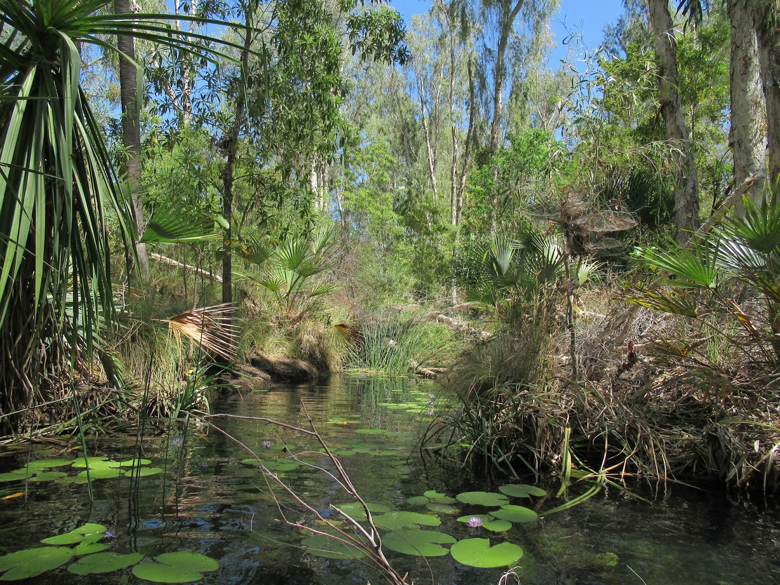
Our campsite at Adels Grove was a surprise. Tall trees, on the bank of a tranquil river with lilies and transparent waters. It was remarkable to encounter this green and pleasant oasis. With first light the songs of the birds woke us slowly and the fresh breeze was a caress.

Nuestro campamento en Adels Grove fue una sorpresa. Árboles altos a la orilla de un río tranquilo con las aguas transparentes y llenas de flores de agua. Fue notable encontrarse con este oasis verde y agradable. Con la primera luz el canto de los pájaros nos despertaron lentamente y la brisa fresca fue una caricia.

The gorge
We drove a short distance to reach Boodjamulla National Park, the waters which flow past our campsite flow down from this park, where they descend from springs then form wide pools with waterfalls at several points, creating the Lawn Hill Creek. The creek is confined by the steep cliffs of the gorge, which has cut through the red Constance sandstone. We explored the gorge on the water, preferring this to walking trails on the gorge’s rim, the sensation of the wall
is magnificent.

Transparent waters at Lawn Hill Creek
Condujimos una corta distancia hasta el Parque Nacional Boodjamulla, las aguas que fluyen más allá de nuestro campamento fluyen aguas abajo desde este parque, donde descienden de manantiales y luego forman amplias piscinas con cascadas en varios puntos, creando el arroyo Lawn Hill Creek. El arroyo está confinado por los empinados acantilados del cañon que ha atravesado la arenisca roja de Constanza. Exploramos el cañon a través del agua, prefiriendo esto a caminar por el borde del cañon, la sensación de las paredes
es magnífica.

Channels at the upper section
The park offers two options on the water: the solar powered boat cruise and human powered canoes - we used the second. Close to the slip, the water is full of lilies, it’s so clear that is easy to see the the roots of the plants and the fish weaving between them, different trees and palm accompanies the watercourse and many small birds fly around. At the end of the middle section
we arrived at Indarri Falls, where a dock is available to tie up the canoe so that one may swim below the falls. One can also portage the canoe to the upper section of the creek and continue as far as the small channels where water flows into the upper part of the gorge; we chose to do this, to explore the upper part, returning for a swim at the falls on the way back. In this section, the landscape continued astonishing and the water of the pool at the base of the falls highly refreshing.


El parque ofrece dos opciones en el agua, un crucero en un barco propulsado por energía solar y canoas que usan energía humana, utilizamos la segunda. Cerca de la entrada al agua, el arroyo está lleno de flores de agua, la cual es tan clara que es fácil ver las raíces de las plantas y los peces que tejen entre ellas, diferentes árboles y palmeras acompañan el curso de agua y varias aves pequeñas vuelan alrededor. Al final de la parte central, llegamos a las cataratas Indarri, hay un muelle disponible para amarrar la canoa y nadar debajo de las cataratas. También, se puede transportar la canoa a la sección superior del arroyo y continuar hasta alcanzar los pequeños canales donde el agua fluye hacia la parte superior del cañon, elegimos hacer esto, explorar la parte superior y nadar en las cataratas en el camino de regreso. En la sección superior el paisaje continua impresionante y las aguas en la piscina a la base de la catarata altamente refrescantes.

Fish at the upper section
After a short rest we took a walking trail to explore the lower part of the creek; on the way large trees which had evidence of previous flooding stand on grey sandy land, then we walked around the base of the the island stack, whose walls have evidence of aboriginal art; finally, at the lookout onto the lower section of the gorge, we rested while we enjoyed the silence and tranquillity of the place, with bowerbirds courting, sulphur-crested cockatoos flying back and forth, and a wallaby grazing at the water’s edge.
Wallaby at lower section of Lawn Hill Creek
Después de un pequeño descanso, tomamos un sendero para explorar la parte inferior del arroyo, en el camino se erigieron grandes árboles que tenían evidencia de inundaciones preciosas en una tierra de arena gris, luego caminamos alrededor de la base de la pila de la isla, cuyas paredes tiene evidencia de arte aborigen, finalmente, en el puesto de observación de la sección inferior, descansamos mientras disfrutamos del silencio y la tranquilidad del lugar, con great bowerbird cortejandose, cacatúas de cresta azufre volando de un lugar para otro, mientras un wallaby se asoma tranquilo al borde del aguas.

Abrazos, Hugs

Alan y Marce

Photos may be used for non-commercial purposes with credit to alanymarce@gmail.com

Saturday, August 24, 2019

Crossing the Simpson Desert


Leaving Coober Pedy
Aug 17-23

Mt Dare is the real starting point for the Simpson desert crossing, because it's the last gas station available and the last chance to buy things for the trip and of course the last pub.  To arrive there we had to drive 425 Km, initially through the moon desert until Oodnadatta, and then through more arid lands to Witjura National Park to cross it from south to north on the west side.

Dog Fence on the way to Oodnadatta
Mt Dare es el verdadero punto de partida del cruce del desierto de Simpson, porque es la última estación de servicio disponible, la última oportunidad de comprar cosas para el viaje y, por supuesto, el último bar. Para llegar allí tuvimos que conducir 425 km a través de Moon Desert inicialmente hasta Oodnadatta y luego a través de otras tierras áridas hasta el Parque Nacional Witjura para cruzarlo de sur a norte, en el lado occidental

Moon Desert

The moon desert is an extent of land covered with a rocky surface which glistens with the reflection of the sunlight, creating a silver colour all around, and in some cases the sense of small glass waterfalls. After 200 Km we arrived at the Pink Roadhouse in Oodnadatta, an iconic place on the route, created in the eighties after the closure of the train route, with the intention of putting the place on the map and ensuring a future for its people. The camp is basic, but the pub was alive, the restaurant was useful, and it really is the last place to buy groceries.

Moon Desert es una vasta extensión de tierra con una superficie rocosa que brilla con el reflejo de la luz solar, creando un color plateado a su alrededor y, en algunos casos, la sensación de pequeñas cascadas de vidrio. Después de 200 km llegamos a Pink Roadhouse en Oodnadatta, un lugar icónico en la ruta, creado en los ochentas, después del cierre de la ruta del tren, con la intención de poner el lugar en el mapa y asegurar un proyecto de futuro para su población. El campamento es básico, pero el pub estaba vivo, el restaurante fue útil y es realmente el último lugar para comprar víveres.

Ruins of the Dalhousie Station

Next day with the song of the birds and the noise of other travellers we woke up to move north. The road was not memorable; more of the same flat landscape, and the road in bad condition following  20 Km of crests, and then the road inside the park which was no better. On the way we found Dalhousie Springs, it was amazing to find this water in this arid land, a big hot pool, with pool noodles available to use. We changed into swimsuits and entered the water with smiles on our faces, it was so good! After a moment, small fish  came to investigate our culinary attributes and some swallows and ducks accompanied us.

Dalhausie Springs
Al día siguiente, con el canto de los pájaros y el ruido de otros viajeros, nos despertamos para ir al norte. El camino no fue memorable, más de paisaje plano y ruta en malas condiciones, luego 20 km de crestas y luego el camino dentro del parque que no fue para nada mejor. En la ruta encontramos Dalhousie Springs, fue increíble encontrar este cuerpo de agua en esa tierra árida, una gran piscina caliente, con fideos disponibles para usar. Nos pusimos los trajes de baño y entramos al agua con una sonrisa en nuestras caras ¡fue muy rico! Después de un momento, pequeños peces vinieron a investigar nuestros atributos culinarios y algunas golondrinas y patos nos acompañaron.

Vandanus Gigantus
We had 70 Km more ahead of us to reach Mount Dare; the road let us drive at no more than 40 Km/h, and so on our long trip we were able spot a big goanna, the Vandanus Gigantus. It was calm, stopped to observe us attentively, and then lifted its body to continue on its way with elegant steps.


Teníamos 70 Km más por delante para llegar a Monte Dare, el camino nos permitió conducir a no más de 40 km, por lo que en nuestro largo viaje pudimos ver una gran goanna, el Vandanus Gigantus. Estaba tranquilo, se detuvo para observarnos con atención, y luego levantó su cuerpo para continuar su camino con elegantes pasos.

In Mount Dare, the camp ground was more basic; although our neighbours told us that there was no hot water we found that we could in fact take a last hot shower before the desert. Other than the opportunitity to obtain park passes,  petrol, and full advice about the route, there is not much else there, but a good beer with food is always appreciated.

En Mount Dare, el campamento fue más básico comparado con el anterior, aunque nuestros vecinos dijeron que no había agua caliente, sin embargo estuvimos afortunados y pudimos darnos una última ducha caliente antes del desierto. Además de adquirir  los pases de los parques, la gasolina y los consejos sobre la ruta, no hay mucho más allí, pero siempre se agradece una buena cerveza con comida.

Sandy way
At this point our planned route was to be 777 Km from Mount Dare to Birdsville. The first 70 Km were to return to Dalhousie Springs where we again enjoyed a dip in the waters. After our spa session, we put up the sand flag and the antenna, and set off. Very soon the road became sandy and the dunes started to appear, gradually we became accustomed to crossing the red sand dunes repeatedly. Arriving at Purni Bore,  a flock of Galahs and Corellas were posing on the ground and the trees around, escaping from the strong wind of the day. During our break, both flocks tried to take off, however after a brief fight against the wind they landed again, their brief flyover was magnificent.

Corellas waiting for better weather
En este punto, nuestro plan de ruta era  recorrer 777 km desde Mount Dare hasta Birdsville. Los primeros 70 km fueron para regresar a Dauhouse Spring, donde nuevamente disfrutamos de una inmersión en las aguas. Después de nuestra sesión de spa, colocamos la bandera de arena, la antena y partimos. Muy pronto el camino fue mas arenoso y aparecieron las dunas, gradualmente nos acostumbramos a cruzar las dunas de arena roja repetidamente. Al llegar al agujero de Purni Bore, una bandada de Galas y Corellas posadas en el suelo y los árboles alrededor, escapando del fuerte viento del día. Durante nuestro descanso, ambas bandadas intentaron despegar, sin embargo, después de una breve pelea que ganó el viento aterrizaron de nuevo, este breve sobrevuelo fue magnífico.

Our first campsite
We continued eastward, into the Desert Simpson Conservation Reserve, and at the end of the afternoon camped between two dunes, while now we were fighting with the wind and the low temperature.

Continuamos hacia el este, hacia Desert Simpson Conservation Reserve, y al final de la tarde acampamos entre dos dunas, mientras ahora éramos nosotros los que luchamos con el viento y la baja temperatura.

Dingo tracks
Rising with the sun, we breakfasted and then set off in the same direction following the dingo tracks.  The dunes were badly chopped up by the passage of many vehicles, so we left the French line as recommended and with this evidence of the track's condition to take the rig road. The extent of the desert was impressive, the solitude, the limitless space, and the consistency of the elements were intriguing. During the last part of the morning the flight of a falcon made a show and in the afternoon the flowers in the centre of the road were the spectacle. The night was warmer, or less cold, the food delicious, the music exceptional, and we had time to enjoy the starry sky.

Wild Flowers on the road
Saliendo con el sol, desayunamos y luego partimos en la misma dirección siguiendo las huellas del dingo. Las dunas estaban muy picadas por el paso de muchos vehículos, dejamos la línea francesa, después de verificar la evidencia,  para tomar Rig Road, la ruta recomendada. La extensión del desierto fue impresionante, la soledad, el espacio ilimitado y la consistencia de los elementos fueron intrigantes. Durante la última parte de la mañana, el vuelo de un halcón hizo el show y por la tarde las flores en el centro de la carretera fueron el espectáculo. La noche fue más cálida, o menos fría, la comida deliciosa, la música excepcional y tuvimos tiempo de disfrutar del cielo estrellado.
Consecutive dunes
The next day we started with a short walk around the dunes close to our campsite with coffee; very soon we were amazed by the number of tracks visible, their diversity, and the incredible shapes created on the sand, we also found some deep holes and tracks which indicated the transit of a mammal. The route was more difficult, we took Knolls Track to the north; this track was very undulating, rocky, and narrow,; at the same time the landscape was more interesting. The flowers were more abundant, we also found places with a complete garden, when we stopped to appreciate them we found a great diversity. In the second part of this track, we found between the dunes a more wooded area with Acacia and Grevillea trees, and consequently there were small birds around. Later, the salt lakes appeared, a big white flat expanse was interrupted only by vehicle racks;  arriving back on the French Line the track was more and more demanding.
More of the track
Al día siguiente comenzamos con un pequeño paseo por las dunas cercanas a nuestro campamento con café, muy pronto nos sorprendimos con la cantidad de huellas visibles, su diversidad y las increíbles formas creadas en la arena, también encontramos algunos grandes agujeros profundos, y huellas que indican el tránsito de un mamífero mas grande. La ruta fue más difícil, tomamos Knoll Track hacia el norte, la pista era muy ondulada, rocosa y estrecha, al mismo tiempo, el paisaje fue más interesante. Las flores fueron más abundantes, también encontramos lugares con un jardín completo, cuando nos detuvimos a apreciarlas encontramos una gran diversidad. En la segunda parte de esta pista, encontramos entre las dunas un área con más arboles de acacias y Grevilleas, y en consecuencia pequeños pájaros alrededor. Más tarde, aparecieron los lagos de sal, un gran piso blanco se expande y solo fue interrumpido por las huellas de los automóviles, llegando a la línea francesa las pistas fueron cada vez más exigentes.

Salt lake between dunes
Bigger dunes
On the French Line, the dunes were bigger and sandier, the road was more undulating, and the possible speed low, we had to cross multi-crested dunes and some sections with deep holes. We crossed a sequence of salt lakes with demanding dunes between them. After 90 Km and 7:40 hours of travel, including the exhausting task of refuelling the car from the reserve cans on the roof, we stopped to rest and prepared for the evening's activities.

Going up
En la línea francesa, las dunas fueron más grandes y con arena más suelta, el camino fue más ondulado y la velocidad posible baja, tuvimos que cruzar dunas con múltiples crestas y algunas secciones con agujeros profundos. Cruzamos una secuencia de salares con dunas exigentes entre ellos. Después de 90 km y 7:40 h de viaje, mas la agotadora tarea de reabastecer de combustible el automóvil con la reserva en el techo, nos detuvimos para descansar y prepararnos para las actividades de la sesión nocturna.

Gibbers on the road

Finally we found a place in which it was allowed and safe to create a fire, our first one in Australia!! We sat down close to the campfire to enjoy its warmth.

Finalmente encontramos un lugar en el que fue permitido y seguro hacer fuego, ¡el primero en Australia! Nos sentamos cerca de la fogata para disfrutar del calor.

The fire
We arrived at Poeppel Corner to check the three border point between Queensland, Northern Territory, and South Australia; after that a flat surface in a “nameless” lake served as the road to the junction with QAA Line; during the day we were ascending and descending dunes, each time we crossed a dune crest the view which appeared was more or less identical to the previous one, this doesn’t mean that the views were not spectacular, woodlands of acacia making green the yellowish sand, with a clear blue sky.

Deep tracks
Llegamos a Poeppel Corner para verificar los tres puntos fronterizos entre Queensland, Northern Territory y South Australia, después de eso, la superficie plana en un lago "sin nombre" nos sirvió el camino hasta el cruce con la línea QAA, durante el día estuvimos ascendiendo y descendiendo dunas, cada vez que cruzamos una cresta de duna, la vista que aparecía era más o menos idéntica a la anterior, lo que no significa que la vista no fuera espectacular. Los bosques de acacia convirtieron en verde la arena amarillenta, con un cielo azul claro.

New colours between dunes
However as we approached Eyre Creek, upon crossing a dune 5 Km from the creek, the valley between the dunes had a new height in the trees; after the next dune the desert floor was a lush green expanse, repeated crossing the next two dunes, and then as we descended the last time to the creek we saw tall trees and greenery everywhere.


Sin embargo, a medida que nos acercamos a Eyre Creek, al cruzar una duna a 5 km del arroyo, el valle entre las dunas tenía una nueva altura de arboles, después de la siguiente duna, el suelo del desierto era una exuberante extensión verde,  que se repitió cruzando las siguientes dos dunas, y luego, cuando descendimos por última vez al arroyo, vimos árboles altos y vegetación en todas partes.

Valley between dunes
The ground was a carpet of flowers and leaves, with intense colours and animated by the song of the birds which had been very absent the days before. The water in the creek had a beautiful milky green water, rich with mud. We consider edtaking a dip in the water, but on closer inspection it was not sufficiently inspiring to do so, in addition to the presence of a large population of flies landing on us. To distract our attention we used the rest of the daylight for birding and then when the temperature dropped the flies went to sleep.

El suelo era una alfombra de flores y hojas, con colores intensos y animada por el canto de los pájaros, que fueron muy ausentes en los días anteriores. El agua del arroyo tenía una hermosa agua verde lechosa, rica en lodo. Consideramos entrar al agua, pero una inspección más cercana no fue lo suficientemente inspiradora para hacerlo, además de una gran población de moscas que aterrizaron en nosotros. Para distraer nuestra atención, usamos el resto del día para observar aves y luego cuando la temperatura bajo, la moscas se fueron a dormir.

More dunes
During this day on the one hand the track between dunes became less irregular, making it possible to travel more quickly, however corrugations appeared making the trip tiring; on the other hand, the dunes were consistently high, and badly chopped up.

Durante este día, por un lado, el camino entre las dunas se volvió menos irregular, haciendo posible viajar más rápido, sin embargo, las corrugaciones aparecieron haciendo agotador el viaje; Por otro lado, las dunas fueron consistentemente altas y muy picadas.

Bigger dunes
Our last day started with the sound of birdsong,  just opening the door it was possible to see a small red chat taking the first rays of sun. After the routine tasks, and after waving at another 10 cars passing, we took the road east. The traffic was significantly higher that day, and now the sand flag and the radio were indispensable to make the trip safe. In the last section, the dunes are taller, and it was almost impossible to see other cars in the distance unless they were at the top of the next dune. At the end the famous Big Red, 40 m high, is an iconic place. We stopped the car and saw the others play the game of ascending the dune using the 5 different tracks; after a while we made our ascent successfully reaching the top, where the wind was blowing strongly creating a very soft surface at the crest.
The view from Big Red
 Nuestro último día comenzó con el sonido del canto de los pájaros, al abrir la puerta, fue posible ver una pequeño red Chat tomando los primeros rayos de sol. Después de la tarea normal, y de agitar las manos para saludar a otros 10 autos pasando, tomamos el camino hacia el este. El tráfico fue significativamente mayor ese día, y ahora la bandera de arena y la radio fueron indispensables para que el viaje fuera seguro. En la última sección, las dunas son más altas y es casi imposible ver otros autos en la distancia, excepto si estuvieran en la parte superior de la próxima duna. Al final, la famosa Big Red, de 40 m de altura, es un lugar icónico. Detuvimos el auto y vimos a los demás, jugando a ascender la duna usando las 5 pistas disponibles, después de un tiempo hicimos nuestro ascenso con éxito para alcanzar la cima, allí el viento soplaban fuerte creando una superficie muy suave en la parte superior.

On the top of the Big Red dune
Finally, we arrived at Birdsville: a cold drink, a light snack, and a warm shower were the main components of our celebration, along with the preparation for a busy afternoon cleaning all the dust. Great adventure, great learning, and great destination to repeat.

Finalmente, llegamos a Birdsville, una bebida fría, un refrigerio ligero y una ducha tibia fueron el componente principal de nuestra celebración, y la preparación para una tarde ocupada limpiando todo el polvo. Gran aventura, gran aprendizaje y gran destino para repetir.

Abrazos

Alan y Marce

PS. Photos may be used for non-commercial purposes with credit to alanymarce@gmail.com

Discover the Dreaming: our ten month exploration - thanks, maps, statistics, and toys

This post is intended to capture some statistics, for those who appreciate them, and also to note some details of our vehicle, where w...